PS3: Mediterranean -Portugal
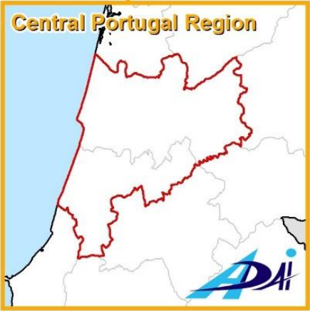
Location: Central Region of Portugal
Fire risk reduction and prevention, Forest management, WUI
The key focus of the Portuguese PS demonstration event shall be placed on Fire risk reduction, Fire risk prevention, Forest management, WUI fire risk characterization, WUI fire risk prevention; Other topics shall also be addressed.
The Portuguese Central Region (Região Centro de Portugal) will locate this demonstration: Coimbra Intermunicipal Community and Leiria Intermunicipal , covering a total area of 6784.69 km2; The region enjoys a mesothermic humid climate, with dry-long summers, moderately hot (Köppen: Csb) with Atlantic oceanic influence. Forest covers 50% of the land. Eucalyptus globulus and Pinus pinaster are the predominant forest species mostly in mixed stands, lacking management. In the last 15 years, growth and expansion of Eucalytus has been remarkable. Small Quercus robur sites confirm the Atlantic influence, Laurus nobilis in the thermophilic valleys, Quercus faginea and Ericetum umbellatae. Shrub species are Cytisus spp, Genista spp, Erica spp. and Ulex spp. Castanea sativa stands are also present.
The fire history recalls large or very large fires burning the same locations recurrently. The fire regime has varied, associated to climate change, with long drought periods and frequent heat waves increasing fire occurrence and severity and consequently increasing the difficulty to extinguish them. Large fires are more common, as those occurred in 2017.
The historical fire season from July to September, now begins in June and ends in October as can also be seen from the before mentioned very large fires occurred in 2017 in June and October.
The most relevant values at risk (HVRA) are small settlements and isolated houses and industries, generate a WUI throughout most of the area. They are highly vulnerable to fire occurrence, as are their populations.
The predominant land use is Forest. Most property is private and of very small. In the inland region, forest management was part of agriculture and pasture, but aged population and urban migration, have fostered severe fuel load growth, very difficult to manage anda key factor for severe fires. Future forest destruction due to fires is expected to worsen. As climate change has increased fires frequency and the destructive power, efforts must be combined to implement measures in order to adapt forest management to the future scenarios. In terms of forest economy timber extraction for the pulp industry is key across the territory. Biomass is produced from wood chip residues of the main forestry activities.
Forest fuels management is a key action for forest fire prevention, carried out at local, municipal, and regional levels by the Institute for Nature Conservation and Forests (ICNF). Forest ecosystem managers and policy-makers thus face the challenge of developing effective fire prevention policies.
Fire perimeters and severity and post-fire risk of landslide and erosion provided by the Copernicus- Emergency Management Service of the EU. These products are made on demand (by the National Authorities) for specific fire events and are based on high and very high-resolution satellite images (Sentinel-2 and SPOT 5&6). Land Use and Occupation for 2007, 2010, 2015 and 2018 (COS, delivered by the Portuguese Directorate-General for Territory - DGT ) and Corine Land Cover for 1990, 2000, 2006, 2012 and 2018 (CLC, delivered by the Copernicus Land Monitoring Service of the EU). Fire history data, namely, spatial (perimeters) and alphanumeric (description), provided by the National Institute for the Conservancy of Nature and Forests (ICNF). Fuel models (NFFL models, Portuguese specific models) spatial and alphanumeric data, also provided by ICNF. National Forestry Inventory, containing forestry data based on field sampling, provided by ICNF. Site specific fuel models developed by ADAI to characterize the Central Region of Portugal. Digital Terrain Model, with a resolution of 30 meters, provided by the Earth Observation System of NASA. Census of the population, both spatial and alphanumeric, for the years of 1991, 2001 and 2011, provided by the National Statistics Institute. Atlas of the Environment, a set of vector data, provided by the Portuguese National Environmental Agency, broadly characterizing distinct aspects of the Portuguese Mainland, like types of soil, soil capacity, climate variables, ecology, hydrography, landscape, etc. Structural Fire Risk for the Portuguese mainland, a raster dataset provided by ICNF. Daily Fire Weather Index observations and predictions for the Portuguese Mainland, both spatial and alphanumeric, provided by the Portuguese Institute for Sea and Atmosphere (IPMA).
Climate and Weather: Data from the Portuguese Institute for Sea and Atmosphere (IPMA).
The Space team has made the following datasets and collections publicly available. You must be a logged-in member of the Space to access all the datasets and collections.
Datasets
Viewing most recent datasets View All Datasets
PS3-Houses value (HV)
Houses Value
PS3-Ecological values Eva)
Ecological Value
PS3-Recovery time (RT)
Recovery Time
PS3-Coping capacity (CC)
Coping Capacity
PS3-Danger: Danger (D)
Danger-D
PS3-Danger: Probability of Ignition (PI)
Danger-PI
PS3-Vulnerability: Ecological Vulnerability (EV)
Vulnerability-Ecological
Collections
There are no public collections associated with this Space.
The following datasets have been published through this Space and any affiliated Spaces.
Statistics
| Collections | 1 |
| Datasets | 39 |
| Files: | 199 |
| Bytes: | 976.8 MB |
| Users: | 89 |
External Links
No External Links
Access
PRIVATE
You are not authorized to access this Space